Chart Plotters for Recreational Boating: Your Ultimate Guide
Posted on , Last Updated
Chart plotters are an essential tool for recreational boaters who want to navigate safely and efficiently on the water. These devices combine GPS technology with electronic charts to provide real-time information about the boat's position, speed, and direction. They are particularly useful for boaters who are navigating in unfamiliar waters or who need to avoid hazards such as shoals, rocks, or other vessels.
One of the main advantages of chart plotters is that they allow boaters to track their progress and plan their route in advance. By overlaying electronic charts on top of GPS data, chart plotters can display a wealth of information about the surrounding area, including depth contours, landmarks, and navigation aids. This makes it easier for boaters to stay on course and avoid running aground or getting lost. Chart plotters can also be used to mark waypoints, which are specific locations on the chart that the boater wants to navigate to or avoid.
However, it's important to remember that chart plotters are just one tool in a boater's navigation toolkit. They should always be used in conjunction with other navigational aids, such as paper charts, compasses, and visual references. Boaters should also be familiar with basic navigation techniques, such as dead reckoning and triangulation, in case their electronic devices fail or lose signal. With the right preparation and knowledge, chart plotters can be a valuable asset for recreational boaters looking to explore new waters with confidence.
Understanding Chart Plotters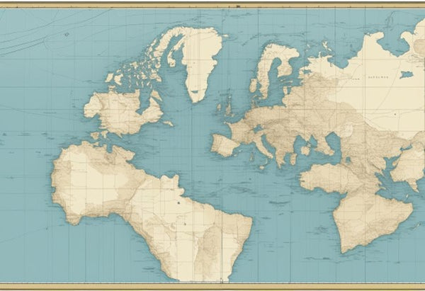
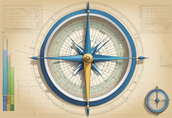
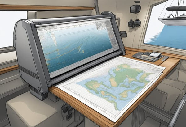
Chart plotters are electronic devices that display digital charts and allow boaters to plot courses and navigate them. They have become an essential tool for recreational boating, providing accurate and up-to-date information about water depth, navigation hazards, and other important details.
Basics of Chart Plotters
Chart plotters use GPS technology to track the boat's position and display it on a digital chart. They come in a range of sizes and styles, from handheld devices to large multi-function displays. Some chart plotters are designed to work with radar, sonar, and other marine electronics, while others are standalone units.
One of the key features of chart plotters is their ability to create and store waypoints, which are specific locations on the water that a boater may want to return to later. Chart plotters can also create and store routes, which are pre-planned paths between waypoints.
Another important feature of chart plotters is their ability to display real-time information about the boat's speed, heading, and other important details. This information can be used to help the boater navigate safely and efficiently.
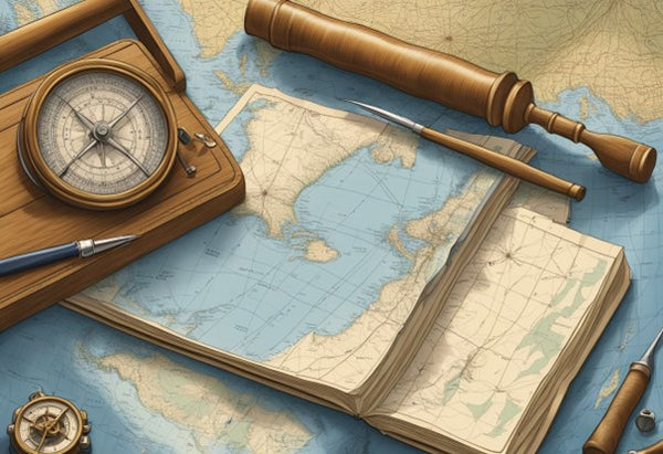
Chart Plotters Vs Paper Charts
While paper charts have been used for centuries to navigate the seas, chart plotters offer several advantages over traditional paper charts. For one, chart plotters are much more accurate and up-to-date than paper charts, which may be several years old. Additionally, chart plotters allow boaters to zoom in and out of the chart to get a better view of the surrounding area.
Another advantage of chart plotters is their ability to overlay other important information on the chart, such as radar and sonar data. This can help boaters avoid navigation hazards and other obstacles.
However, it is important to note that chart plotters should not be used as a replacement for other important navigation tools, such as a compass or GPS position. Rather, they should be used in conjunction with these tools to provide the most accurate and comprehensive navigation information possible.
In summary, chart plotters are an essential tool for recreational boaters, providing accurate and up-to-date information about water depth, navigation hazards, and other important details. While they offer several advantages over traditional paper charts, they should be used in conjunction with other important navigation tools to provide the most accurate and comprehensive navigation information possible.
Key Features of Chart Plotters
Chart plotters are an essential tool for recreational boaters. They provide accurate navigation information, allowing boaters to easily navigate through waterways. Chart plotters come with a variety of features that make them useful for different types of boating activities. Here are some of the key features of chart plotters:
GPS Functionality
One of the most important features of a chart plotter is its GPS functionality. This allows the device to accurately track the boat's position, speed, and direction. It also allows the user to set waypoints and plot courses, making it easier to navigate through unfamiliar waters. Some chart plotters come with built-in GPS, while others require an external GPS antenna.
Bluetooth and Wifi Connectivity
Many chart plotters now come with Bluetooth and Wifi connectivity. This allows the user to connect the device to a smartphone or tablet, providing access to additional features such as weather updates and social media. It also allows for wireless updates and software upgrades.
LCD Display and Dual Functionality
A chart plotter's LCD display is an important feature that allows the user to easily view navigation information. Many chart plotters now come with touch screen displays, making it easier to interact with the device. Some chart plotters also come with dual functionality, allowing them to be used as both a chart plotter and a fish finder.
Overall, chart plotters are an essential tool for any recreational boater. They provide accurate navigation information, making it easier to navigate through unfamiliar waters. With features such as GPS functionality, Bluetooth and Wifi connectivity, and LCD displays, chart plotters are becoming increasingly versatile and user-friendly.
Manufacturers of Chart Plotters
When it comes to chart plotters, there are a number of manufacturers that produce high-quality devices suitable for recreational boating. Two of the most prominent manufacturers are Garmin and Lowrance Hook, but there are other manufacturers that are also worth considering.
Garmin
Garmin is a well-known manufacturer of GPS devices and chart plotters for recreational boating. Their Garmin GPSMAP series is highly regarded in the industry for its ease of use and reliability. The devices are available in a range of sizes, from 7 inches to 24 inches, and offer a range of features, including touchscreens, wireless connectivity, and built-in sonar.
Other Prominent Manufacturers
In addition to Garmin, there are other manufacturers that produce high-quality chart plotters for recreational boating. Lowrance Hook is another well-known manufacturer that produces a range of devices suitable for different types of boating. Their devices are known for their advanced sonar capabilities and easy-to-use interfaces.
Other prominent manufacturers include Raymarine, B&G, and Furuno. Raymarine produces a range of chart plotters that are designed for cruising, sailing, and fishing. They offer a range of features, including augmented reality and 360-degree views. B&G produces chart plotters that are designed for racing and offer features such as a race panel and powerful look-ahead capabilities. Furuno produces a range of GPS and chart plotters that are known for their reliability and accuracy.
When choosing a chart plotter, it is important to consider factors such as size, features, and price. It is also important to choose a device that is compatible with your boat and other electronics. By doing your research and considering your needs, you can find a chart plotter that will meet your needs and help you navigate safely and effectively while out on the water.
Using Chart Plotters for Navigation
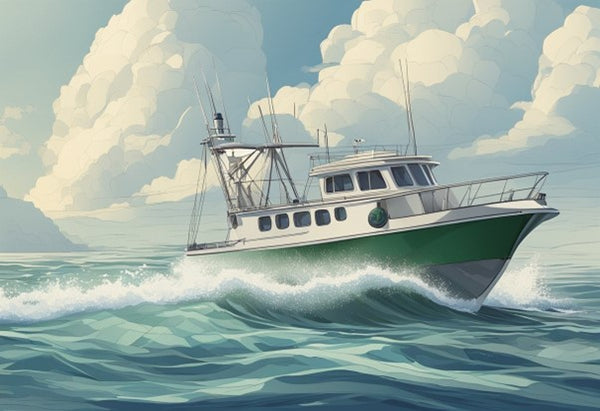
Chart plotters are an essential tool for boaters to navigate through the waterways. They are designed to provide accurate and up-to-date information on the location, direction, and depth of the water. Here are some tips on how to use chart plotters for navigation.
Planning Your Route
Before setting out on a boating trip, it is important to plan your route carefully. Chart plotters can help you do this by showing you the location of obstacles, such as rocks and sandbars, and allowing you to plan a safe route around them. You can also use the chart plotter to mark waypoints along your route, which can help you navigate more easily.
Reading the Charts
Chart plotters use charts to display the location and depth of the water. It is important to understand how to read these charts to ensure accurate navigation. The charts will typically include symbols that represent different features of the water, such as buoys and navigational markers. The chart plotter will also display your boat's location and direction, which can help you stay on course.
Accuracy and Depth Perception
One of the most important aspects of using a chart plotter is ensuring accuracy and depth perception. Chart plotters use GPS technology to determine your boat's location and display it on the chart. It is important to ensure that your GPS is properly calibrated to ensure accurate navigation. Additionally, it is important to understand the depth perception displayed on the chart. The chart plotter will display the depth of the water, but it is important to remember that this is only an estimate and may not be completely accurate.
Overall, chart plotters are an essential tool for safe and accurate navigation on the water. By understanding how to use them properly, boaters can ensure a safe and enjoyable boating experience.
Chart Plotters and Fishing
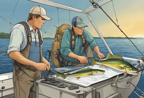
Chart plotters are an essential tool for recreational boaters who love fishing. With the help of a chart plotter, boaters can locate fishing spots, mark them, and navigate to them with ease.
Locating Fishing Spots
A chart plotter lets boaters locate and mark their favorite fishing spots. They can mark the location of a fishing spot, and the chart plotter will remember it for future use. Boaters can also add notes to the marked location, such as the type of fish they caught or the bait they used.
In addition, chart plotters can help boaters find new fishing spots. Boaters can use the chart plotter to identify areas with a high probability of fish. They can look for areas with underwater structures, such as reefs, rocks, or holes, where fish are more likely to congregate.
Depth Readings for Fishing
Depth readings are crucial for successful fishing. With a chart plotter, boaters can get accurate depth readings in real-time. They can use the depth readings to determine the depth at which fish are swimming and adjust their bait or lures accordingly.
Boaters can also use the chart plotter to identify changes in depth, which can indicate the presence of underwater structures. They can look for areas where the depth drops suddenly, indicating the presence of a hole or underwater canyon. These areas are often prime fishing spots.
In summary, chart plotters are an indispensable tool for recreational boaters who love fishing. They allow boaters to locate and mark fishing spots, find new fishing spots, and get accurate depth readings in real-time. With a chart plotter, boaters can navigate to their favorite fishing spots with ease and increase their chances of success.
Accessories and Add-Ons for Chart Plotters
When it comes to chart plotters, there are a variety of accessories and add-ons available that can enhance their functionality and make them more useful for recreational boating. Here are some of the most important ones to consider:
Mounting Options
One of the first things to consider when using a chart plotter is how it will be mounted. There are several mounting options available, including flush mounting, bracket mounting, and gimbal mounting. Flush mounting involves mounting the chart plotter directly into the boat's console, while bracket mounting involves using a bracket to attach the chart plotter to the console. Gimbal mounting involves mounting the chart plotter on a swivel that allows it to be adjusted to different angles.
Map Chips and Data Cards
Another important accessory for chart plotters is map chips and data cards. These cards contain detailed maps and charts that can be used to navigate waterways and avoid hazards. Some chart plotters come with pre-loaded maps, while others require you to purchase and install the maps separately. It is important to ensure that the map chips and data cards you purchase are compatible with your chart plotter.
Marine Electronics and Accessories
In addition to map chips and mounting options, there are a variety of marine electronics and accessories that can be used with chart plotters. These include marine cameras, sonar modules, radar systems, and more. These accessories can help you to navigate more effectively and avoid hazards, as well as provide additional information about the waterways you are navigating.
When choosing accessories and add-ons for your chart plotter, it is important to ensure that they are compatible with your specific model and that they will provide the functionality you need. By carefully selecting the right accessories, you can enhance the usefulness of your chart plotter and enjoy safer, more effective navigation on the water.
Maintaining and Updating Your Chart Plotter
Keeping your chart plotter up-to-date is crucial for safe and efficient navigation. Regularly updating charts ensures that you have the latest information on water depths, obstructions, and other hazards. Here are some tips for maintaining and updating your chart plotter:
Keeping Your Charts Up-to-Date
To keep your charts up-to-date, you need to regularly download updates from the manufacturer's website or purchase new charts. Most chart plotters have a slot for a data card that stores the charts. You can update the charts by inserting a new data card or downloading updates onto the existing card. It is essential to check the expiration date of your charts and update them before they expire.
Survey Channels and AquaMaps
Survey channels and AquaMaps are two useful tools for maintaining your chart plotter. Survey channels are areas where the water depth has changed, and the charts need to be updated. AquaMaps are overlays that show marine life habitats, conservation areas, and other ecological information. By using survey channels and AquaMaps, you can ensure that your charts are accurate and up-to-date.
To use survey channels and AquaMaps, you need to have a chart plotter that is compatible with these features. Check with your manufacturer to see if your chart plotter supports these tools. If it does, you can download the survey channels and AquaMaps from the manufacturer's website and install them on your chart plotter.
In conclusion, maintaining and updating your chart plotter is crucial for safe and efficient navigation. By keeping your charts up-to-date and using survey channels and AquaMaps, you can ensure that your chart plotter is accurate and reliable. Always check for updates and download them regularly to stay on top of the latest information.
Cost Considerations When Choosing a Chart Plotter
When it comes to choosing a chart plotter for recreational boating, cost is an important factor to consider. Chart plotters can range in price from a few hundred dollars to several thousand dollars, depending on the brand, features, and size. Here are some cost considerations to keep in mind when choosing a chart plotter.
Budgeting for a Chart Plotter
Before purchasing a chart plotter, it's important to determine a budget. This will help narrow down the options and prevent overspending. The cost of a chart plotter can vary depending on the size of the screen, the brand, and the features. It's important to consider what features are necessary and which ones are nice to have but not essential. For those on a tight budget, it may be worth considering a tablet-based chart plotter, which can be a more affordable option.
Cost of Additional Features and Accessories
In addition to the cost of the chart plotter itself, it's important to consider the cost of additional features and accessories. For example, some chart plotters require a satellite subscription to access certain features, which can add to the overall cost. Additionally, some chart plotters may require additional accessories such as transducers, which can also add to the cost. It's important to factor in these additional costs when budgeting for a chart plotter.
Overall, cost is an important consideration when choosing a chart plotter for recreational boating. It's important to determine a budget and consider the cost of additional features and accessories to ensure a chart plotter that meets all necessary needs is chosen.
Frequently Asked Questions
What features should I look for when choosing a chartplotter for recreational boating?
When choosing a chartplotter for recreational boating, there are several features to consider. Firstly, you should look for a chartplotter that has a high-resolution display that is easy to read in different lighting conditions. Secondly, you should look for a chartplotter that has a fast and accurate GPS receiver. Thirdly, you should look for a chartplotter that has preloaded charts and maps for the areas you plan to navigate. Fourthly, you should look for a chartplotter that has the ability to connect to other devices, such as fishfinders, radar, and AIS. Lastly, you should look for a chartplotter that is user-friendly and has a range of features that are suitable for your level of boating experience.
How do I navigate a chartplotter and what are some tips for using it effectively?
Navigating a chartplotter involves using the device to plot your course and monitor your position. To use a chartplotter effectively, you should first familiarize yourself with the device and its features. You should also ensure that the device is set up correctly and that the charts and maps are up-to-date. When using the chartplotter, you should pay attention to the information displayed on the screen, including your position, course, speed, and depth. You should also regularly check the device to ensure that it is functioning correctly and that you are on course. Some tips for using a chartplotter effectively include setting alarms for depth and speed, using the device in conjunction with paper charts, and regularly checking the weather and tides.
What are the best chartplotter brands for recreational boating?
There are several chartplotter brands that are popular for recreational boating, including Garmin, Raymarine, Simrad, and Lowrance. Each brand has its own range of features and benefits, and the best brand for you will depend on your individual needs and preferences. When choosing a chartplotter brand, you should consider factors such as price, functionality, ease of use, and compatibility with other devices.
Are there any disadvantages to using a chartplotter for navigation?
While chartplotters are a valuable tool for navigation, there are some disadvantages to using them. Firstly, chartplotters rely on technology and can malfunction or lose power, which can leave you without a navigation tool. Secondly, chartplotters can be expensive to purchase and maintain, and may require regular updates and upgrades. Thirdly, chartplotters can be complex to use, and may require a significant amount of time and effort to learn how to operate effectively.
Can I use the Navionics Boating app as a standalone chartplotter or do I need additional hardware?
The Navionics Boating app can be used as a standalone chartplotter on a smartphone or tablet, but it is recommended that you use additional hardware, such as a GPS receiver or a wireless sonar, for more accurate and reliable navigation. The Navionics Boating app has a range of features, including detailed charts and maps, weather updates, and navigation tools, but it is limited by the capabilities of the device it is installed on.
What are the most important factors to consider when choosing a chartplotter with Navionics?
When choosing a chartplotter with Navionics, there are several factors to consider. Firstly, you should ensure that the chartplotter is compatible with Navionics charts and maps, and that it has the ability to display them accurately and clearly. Secondly, you should consider the size and resolution of the chartplotter display, as well as its ease of use and functionality. Thirdly, you should look for a chartplotter that has a fast and accurate GPS receiver, and that can connect to other devices, such as fishfinders and radar. Lastly, you should consider the price and maintenance costs of the chartplotter, as well as its durability and reliability.